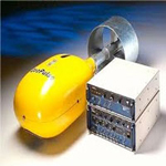
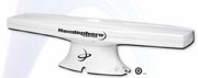
- CANAL GEOMATICS Hemisphere GPS-VectorPRO-111
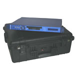
- C-NAV Satellite Positioning System
- C-Nav 1000 DGPS positioning system
- TRIMBLE DSM 132 DGPS System
- TRIMBLE NT 300 DGPS System
- LEICA 421 DGPS Positioning System
- GARMIN DGPS Positioning System
- SANJOSE DGPS Positioning System
|
|
 |
|
|
|
|
|
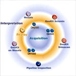
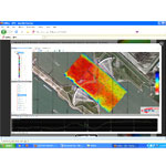
Geophysical data Acquisition, Processing & Interpretation tool
Coda Geosurvey Productivity Suite
- Coda DAseries acquisition, processing & Interpretation systems
- Compatible with all sidescan sonars and sub-bottom profilers including the latest digital sonars and popular analogue systems.
|
|
 |
|
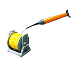
| Depth Measuring System: |
|
|
|
- GeoSwath Plus Multibeam Echo sounder
- Reson Seabat 7101 Multibeam Echo Sounder
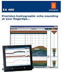
- Kongsberg-EA 400 with SIMRAD 50/200 COMBI-D Transducer
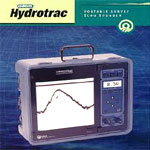
- HydroTracdepth measuring system
- Dual channel ODOM Model MKII 3200
Echotrac Dual Frequency Echo sounder
- Raytheon 719 C Single frequency
Echosounder and Hydro track
|
|
 |
 |
| |
|
|
 |
Heave compensator:
|
|
|
|
- Seatex MRU5 Heave compensator
- SMC S108 Heave compensator
- TSS 333B Heave compensator
|
|
|
|
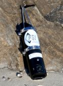
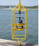
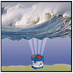
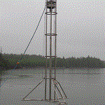
Automatic Tide Gauge:
|
|
|
|
The Falmouth Scientific, Inc. Tide Monitoring System is a complete tide monitoring system for moorings and other long-duration fixed-site deployments. The pressure module is a precision strain-gauge pressure sensor for measuring water level; barometric pressure compensation is provided by a sensor mounted in the system’s surface enclosure, which also incorporates rechargeable battery and system communications. |
|
|
|
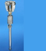
Currentmeters:
|
|
|
|
The Falmouth Scientific, Inc. Tide Monitoring System is a complete tide monitoring system for moorings and other long-duration fixed-site deployments. The pressure module is a precision strain-gauge pressure sensor for measuring water level; barometric pressure compensation is provided by a sensor mounted in the system’s surface enclosure, which also incorporates rechargeable battery and system communications.
|
|
|
|
| |
|
|
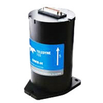
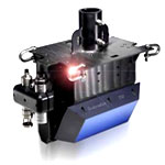
ADCP:
|
|
|
|
Teledyne RD Instruments most popular and versatile Acoustic Doppler Current Profiler (ADCP), the lightweight and adaptable Sentinel is easily deployed on buoys, boats, or mounted on the seafloor. Real-time data can be transmitted through modem or data can be stored internally for short or long-term deployments. |
|
|
|
|
|
|
|
|
|
|
|
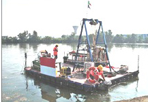
| Seabed Soil Sampling: |
|
|
|
We are equipped with Gravity Corer and Vibro-corer for seabed sampling.The corer is designed for taking samples in sandy sediment featuring detachable core tube with a maximum length of 6 miters and up to 12 metres in soft or muddy sediment. It can also be used as a piston corer
.• Maximum length of core tube: 6 metres
• Detachable core tubes with length of 1, 3 or 5 metres each. |
|
|
Vibro-Corer
|
| Geostar’s indigenously developed equipment. The Van Veen Grab is a useful sampler for taking samples of the bed material in streams, lakes, reservoirs and the ocean. It can be handled easily and deliver a good sample. |
|
|
|
|
|
|
|
|
|
|
| Geotechnical Investigations: |
|
|
|
The foundation of every offshore structure lies in the soil or rock on which it is to be set up, characterization of the soil or rock mass is a first requirement.
• Floating Barge platform
• Sample recovery capacity to a depth of 15m from chart datum
• Rotary driller with diamond bit core bailer of diameter 95 mm
• 100 mm diameter casing to prevent collapse of fractured rocks
• sampling will be done simultaneously by SPT / UDS at regular interval as per IS procedure.
|
|
|
|
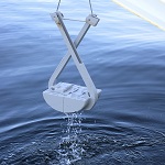
Water Sampling:
|
|
|
|
‘Nansen Reversible Water Sampler’ for obtaining sample of seawater at a specific depth. |
|
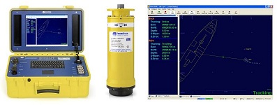
USBL Systems:
|
|
|
|
- Sonardyne Scout USBL is a complete vessel based underwater positioning system for tracking divers, ROVs and towfish. It's compact, portable and easy to install.
|
|
|
|
|
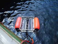
Side Scan Sonar:
|
|
|
|
- Imagenix model 858 Side scan sonar
system (2 sets)
- EG & G 260TH with 262 TD tow fish Side
scan sonar system.
- Edgetech 4100P Digital side scan sonar
system
- EdgeTech’s 4100 Side Scan Sonar System is the long-lasting workhorse of the hydrographic survey.
- The 4100 is a dual frequency 100/500 kHz system that is ideally suited for use in water depths of up to a few hundred meters.
- A standard with the model 272-TD dual frequency towfish, choice of a portable or 19 inch rack mount topside processor running EdgeTech’s DISCOVER software and a customer-specified length of Kevlar or double-armored tow cable.
|
|
|
|
| |
|
|
|
Sub-bottom Profilers:
|
|
|
|
- GeoAcoustics [A Kongsberg Company] GeoPulse is the survey industry's standard Sub-Bottom Profiler system. Its proven success is due to its reliability, ruggedness, ease of operation and flexibility.
- Sub-Seabed structures are delineated using reflexions from a selectable single frequency multi-cycle high power signal
- Towed or hull mounted platform, the signal is processed in the compact deck unit.
Key features
- Selectable transmit frequency 2 to 12 kHz
- Over-the-side, towed or hull mounted deployment
- Reliable, proven, easy to use
- Good penetration and resolution
|
|
Sparker
|
Squid-2000
|
|
|
| |
|
|
|
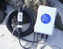
Magnetometer:
|
|
|
|
- Elsec 7706 Littlemore Scientific
SeaSPY’s [from ‘MARINE MAGNETICS’] accuracy is 0.1nT—the highest absolute accuracy of any magnetometer with;
- Isolation transceiver
- RS-232 cable
- 24V universal AC power supply
- BOB logging and GPS capability software for Windows
|
|
 |
|
| |
|
|
|
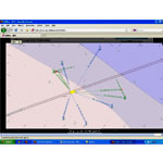
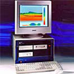
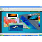
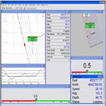
| Navigation and Data Logging
Systems: |
|
|
|
- Qinsy 7.0 Package consisting
Navigation, Processing, Tug mgmt systems, etc.
- HYDRO PRO Package consisting
Navigation, Processing, Tug mgmt systems, etc.
- HYPACK Navigation and data processing
Package.
- Data Radio modems with UHF/VHF
telemetry link with WPC operating license
- Win profile package consisting
Navigation and Processing
- High speed systems
- Multi purpose printers
- Dual display LCD Monitors
|
| |
|
|
|
| |
|
|
|
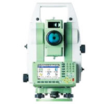
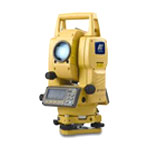
Land Survey Equipment:
|
|
|
|
- Electronic Total station
- Auto level & Theodelite T2
Processing Facility:
- High speed systems
- A-0 plotters
- Multipurpose Printers
- Digitizer
|
|
 |
|
| |
|
|
| |
|
|
|
Software Suites:
|
|
|
|
- HYDROPRO Post processing system
- HYPACK Post processing system
- Qinsy 8.0 Data Acquisition & Post
processing system
- Winprofile Post Process system
- AutoCAD 2008
- CODA-OCTOTUS Processing Suite
|
|
 |
 |
| |
|
|
|
| |
|
 |
|